History
ရႏၲပိုစာခ်ဳပ္
(၁၈၂၆ ခုႏွစ္၊ ေဖေဖာ္ဝါရီလ ၂၄ ရက္ေန႔ ၊ အင္း၀ ေနျပည္ေတာ္ႏွင့္ ၄၅ မုိင္ကြာ ရႏၲပိုရြာ)
ရႏၲပိုစာခ်ဳပ္သည္ ပထမ အဂၤလိပ္ - ျမန္မာစစ္တြင္ ျမန္မာတို႔ ရႈံးနိမ့္ခဲ့ၿပီး ေနျပည္ေတာ္ႏွင့္ ၄၅ မုိင္ကြာေသာ ရႏၱပုိ အရပ္ ခ်ဳပ္ဆုိ ရေသာ စာခ်ဳပ္ျဖစ္သည္။
၁၈၂၆ ခုႏွစ္၊ ေဖေဖာ္ဝါရီလ ၂၄ ရက္ေန႔တြင္ ရႏၱပုိ စာခ်ဳပ္ကုိ ႏွစ္ဖက္ စုံညီစြာ ခ်ဳပ္ဆုိၾကရာ စာခ်ဳပ္ပါ အခ်က္မ်ားမွာ -
ျမန္မာက ရခုိင္၊ တနသၤာရီ၊ အာသံကုိ ၿဗိတိသွ်တုိ႔ထံ ေပးရသည္။
မဏိပူရ၊ ကခ်ာႏွင့္ ဂ်ိန္းတိယ နယ္မ်ားသုိ႔ ျမန္မာတုိ႔ ဝင္ေရာက္ စြက္ဖက္ျခင္း မျပဳရ။
စစ္ေလ်ာ္ေၾကးေငြ ၁ ကုေဋကုိ အရစ္က် ေပးဆပ္ရမည္။
အင္းဝတြင္ ၿဗိတိသွ် ကုိယ္စားလွယ္ ထားခြင့္ျပဳကာ၊ ကလကတၲားတြင္ ျမန္မာသံ ေနခြင့္ျပဳသည္။
ကူးသန္း ေရာင္းဝယ္ေရး အတြက္ စာခ်ဳပ္ သီးျခား ခ်ဳပ္ဆုိမည္။ စသည္တုိ႔ ျဖစ္သည္။
ႏုိင္ငံတကာေရးရာ အဆင့္အတန္းႏွင့္ ဆုိလွ်င္ စာခ်ဳပ္ပါ အခ်က္မ်ားကုိ ျပင္းထန္ လွသည္ဟု မဆုိသာေပ။ ၿဗိတိသွ်တုိ႔သည္ စစ္အတြင္း၌ လူေပါင္း ၁၅,၀၀၀ ဆုံး႐ႈံးခဲ့၍၊ စတာလင္ေပါင္ ၁၃ သန္း သုိ႔မဟုတ္ ေငြသိန္းေပါင္း ၁,၃၀၀ သုံးစြဲခဲ့ရသည္။ မည္သုိ႔ျဖစ္ေစ ျမန္မာတုိ႔ အဖုိ႔ ထုိထက္ပုိ၍လည္း ေပးဆပ္ႏုိင္ျခင္း မရွိေခ်။ ဤအေျခတြင္ ျမန္မာ တႏုိင္ငံလုံးကုိသိမ္းပုိက္ရန္လည္း မျဖစ္ႏုိင္ေသးေပ။
ရခုိင္ႏွင့္ တနသၤာရီ ေဒသကို ရျခင္းျဖင့္ ေနာက္စစ္ပြဲမ်ား ထပ္မံ ျဖစ္ပြားလွ်င္ ျမန္မာႏုိင္ငံတြင္းသုိ႔ တဖက္တခ်က္မွ အလြယ္တကူ ဝင္ေရာက္ႏုိင္သည္ဟု ၿဗိတိသွ်တုိ႔က ယူဆသည္။ ထုိ႔ျပင္ ေဒသ ႏွစ္ခုမွ မၾကာမီ အက်ဳိးအျမတ္ မ်ားစြာ ခံစားရလိမ့္မည္ ဟုလည္း ၿဗိတိသွ်တုိ႔က ေမွ်ာ္လင့္ၾကသည္။
ျမန္မာမင္းဘက္မွ ၾကည့္လွ်င္ ဆုံး႐ႈံး လက္လႊတ္ရေသာ နယ္ေျမမ်ား အတြက္ မေထာင္းသာလွသည္ကို ေတြ႕ရသည္။ ရခုိင္ႏွင့္ တနသၤာရီတုိ႔ကုိ ပုိင္ဆုိင္ထားရျခင္းမွာ ျမန္မာ မင္းအဖုိ႔ဝန္ထုတ္ ဝန္ပုိးသဖြယ္ ရွိေန၍ ထုိေဒသ ႏွစ္ခုကုိ ၿဗိတိသွ် လက္တြင္းသုိ႔ အပ္လုိက္ရေသာ အခါ ျမန္မာမင္းသည္ ျမန္မာႏုိင္ငံ ျပည္မတြင္ ပုိမုိ အာ႐ုံ စူးစုိက္ႏုိင္၍ အက်ဳိး ခံစားဖြယ္ ရွိသည္။᠌᠌᠌
Reference:
↑ ၁၉၆၂ ခု၊ ပဌမႏွိပ္၊ ရန္ကုန္ တကၠသိုလ္၊ ျမန္မာႏွင့္ အေရွ႕တုိင္း ရာဇဝင္ ပါေမာကၡ ေဒါက္တာ ေက်ာ္သက္ ေရးသားတဲ့ 'ျပည္ေထာင္စု ျမန္မာႏိုင္ငံ သမိုင္း'
Delineating British Burma, c. 1826-1949
The three wars
The collection begins with contemporary accounts and official histories of the three wars of 1824-1826, 1852-1854, and 1885-1886. At the conclusion of the 1st War in 1826, Assam, Arakan, and Tenasserim were annexed to the East India Company’s territories. Assam never became part of British Burma, while Arakan was transferred to the government of Bengal and Tenasserim was placed under the direct control of the Governor-General at Calcutta.
After the 2nd War, the Company annexed Pegu and Martaban, thus taking control of the whole of Lower Burma. In 1862, Tenasserim, Pegu, and Martaban were constituted as British Burma, a new province of British India, each under a Commissioner responsible to the Chief Commissioner at Rangoon, who answered directly to the Governor-General. Independent Burma was now a land-locked state, under constant pressure from the British in the south, especially commercial interests seeking new routes into China.
New territories
On January 1st, 1886, the province of British Burma was more than doubled in size by the final annexation of the kingdom of Burma, although sporadic fighting continued until 1889. As the new territories were divided into four commissionerships and Pegu had meanwhile been split into two, British Burma now comprised eight commissioner’s divisions, headed by the Chief Commissioner with a growing administrative secretariat at Rangoon.
The Chief Commissioner was replaced in 1897 by a Lieutenant-Governor, who was assisted by a Legislative Council, enabling Burma-specific legislation to be enacted for the first time under British rule. From January 2nd, 1923, responsibility for a wide range of functions (but excluding, for example, defense and external relations) was devolved to the Government of Burma.
Subordination to India ended with a new constitution, which took effect on April 1st, 1937. The constitution created a Senate – half of which was to be nominated by the Governor – and an elected House of Representatives. The Governor now answered not to India, but to a Secretary of State for Burma in London (although the office was held by whoever was Secretary of State for India).
During the Japanese invasion, the British and Indian elements in the administration retreated to India and set up a Government of Burma in exile at Simla. This government returned in October 1945 to find that power has already passed to the Burmese nationalists. British rule formally ended on January 4th, 1948, and Burma became an independent republic.
Delineating the territories
The first general gazetteer, of 1879, covered Lower Burma only. The second, of 1883, covered Lower Burma and independent Burma, and was followed in 1900-1901 by a massive (3,000-page) compilation, which also included the Shan states. There are also handbooks and a gazetteer issued for war-time use by the government in exile at Simla.
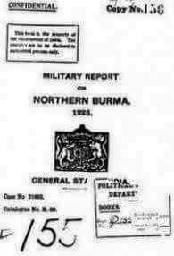
Military reports and route books were produced by the Intelligence Branch at military headquarters in India, and latterly by South-East Asia Command. The route book, which was first issued in 1903, was divided into four parts, namely northern, north-eastern, western, and southern and the Shan states. In the war-time issues, routes labeled C, D, G, H, L, and M survive.
Attempts to define the boundaries of British Burma – an issue that still engages Burma, China, and Thailand – began after the first territorial annexation of 1826, but did not reach the status of an international agreement until the 1890s. The collection has secret/confidential reports from the Anglo-Siamese Commission of 1892-1893, the Amherst (i.e. Tenasserim)-Siam Commission of 1894-1896, the Burma-China Commission of 1894-1899, and the Sino-British Commission of 1935-1936.
The Burma Gazetteer provides a highly detailed, multi-volume account of early twentieth-century British Burma, compiled by the district officers. The Gazetteer is divided into Part A – which comprises monographs on, for example, the history, geography, administration, and economic life of each district – and Part B, which contains tables of statistics. There are A volumes for 26 districts only, produced between 1910 and 1935. The B volumes of statistics appear in three editions, which were published after the census returns of 1901, 1911, and 1921. These are: 1906-1907: 36 volumes (the China Hills and Shan and Karenni states are not included); 1912-1913: 42 volumes, numbered 1-42; 1924-1925: 42 volumes, numbered 1-43 (Rangoon, vol. 5 in 1912, omitted). Included in this section are a number of other works relating to particular districts or states that do not form part of the Burma Gazetteer series.
Provenance and historical background
The various “Secret,” “Confidential,” or “For Official Use Only” works are located in two internal reference libraries, which accumulated within the Military Department (L/MIL/17) and the Political & Secret Department (L/P&S/20) at the India Office in London. Items were received both from Military Intelligence in India and from the Government of Burma. Custody rules for volumes held “in the field” dictated that when a new edition of a particular work appeared, all previous editions had to be destroyed. As a result, these works in their various issues survive in very few locations. The collection in the India Office Records at the British Library is unique in its breadth and accessibility.
The non-classified works (V/27), mainly the volumes of the Burma Gazetteer, are part of the large collection of official publications managed by the Registry & Records Department at the India Office. All the India Office departments were subsumed within the Commonwealth Relations Office (subsequently the Foreign & Commonwealth Office) after India, Pakistan, and Burma became independent in 1947-1948. In 1982, the Foreign & Commonwealth Office transferred the administration of the India Office Library & Records to the British Library, where it now forms one part of the Library’s Asia, Pacific, and Africa Collections (specifically, the former Oriental & India Office Collections; OIOC).
Advisor: A.J. Farrington, Former Deputy Director, Oriental & India Office Collections (OIOC), British Library/i>
http://www.brill.nl/delineating-british-burma-c-1826-1949