my journey to Ziro valley of Arunachal Pradesh, India
I live in Dibrugarh and Ziro is 200 kms away. The road to Ziro is a hilly and scenic one. Five of us rode 3 bikes to Ziro. First we crossed Bahmaputra river by ferry and then crossed Lakhimpur district.
 Ziro is the district headquarters of Subansiri district and is one of the oldest towns in Arunachal Pradesh. It was the headquarters of the undivided Subansiri district comprising the present districts of Upper Subsansiri, Kurung Kumey, Lower Subansiri and Papum Pare. It is located at 27.63°N 93.83°E[2] at an elevation of 1688 metres (5538 feet) to 2438 meters (8000 feet). Its cool weather in summer is its major attraction. It is famous for its pine-clad gentle hills around it and rice field all around. Ziro is home to the Apatani tribe.
The climatic condition of the district varies from place to place as well as season to season. The climate is largely influenced by the nature of terrain depending upon altitude and location of place. It may broadly be divided into four seasons in a year:
The cold weather season is from December to February
March to May is the pre-monsoon season of thunderstorms
The south–west monsoon from June to about the middle of October
The second half of October to November, which constitutes the post-monsoon or the retreating monsoon period and is a period of transition
In the foothills or low high belt area of the district, the climatic condition is moderate in comparison to high belt areas, where during winter it is very cold and chilly, and in summer is pleasant. December and January are generally the coldest month, and July and August are warmest months.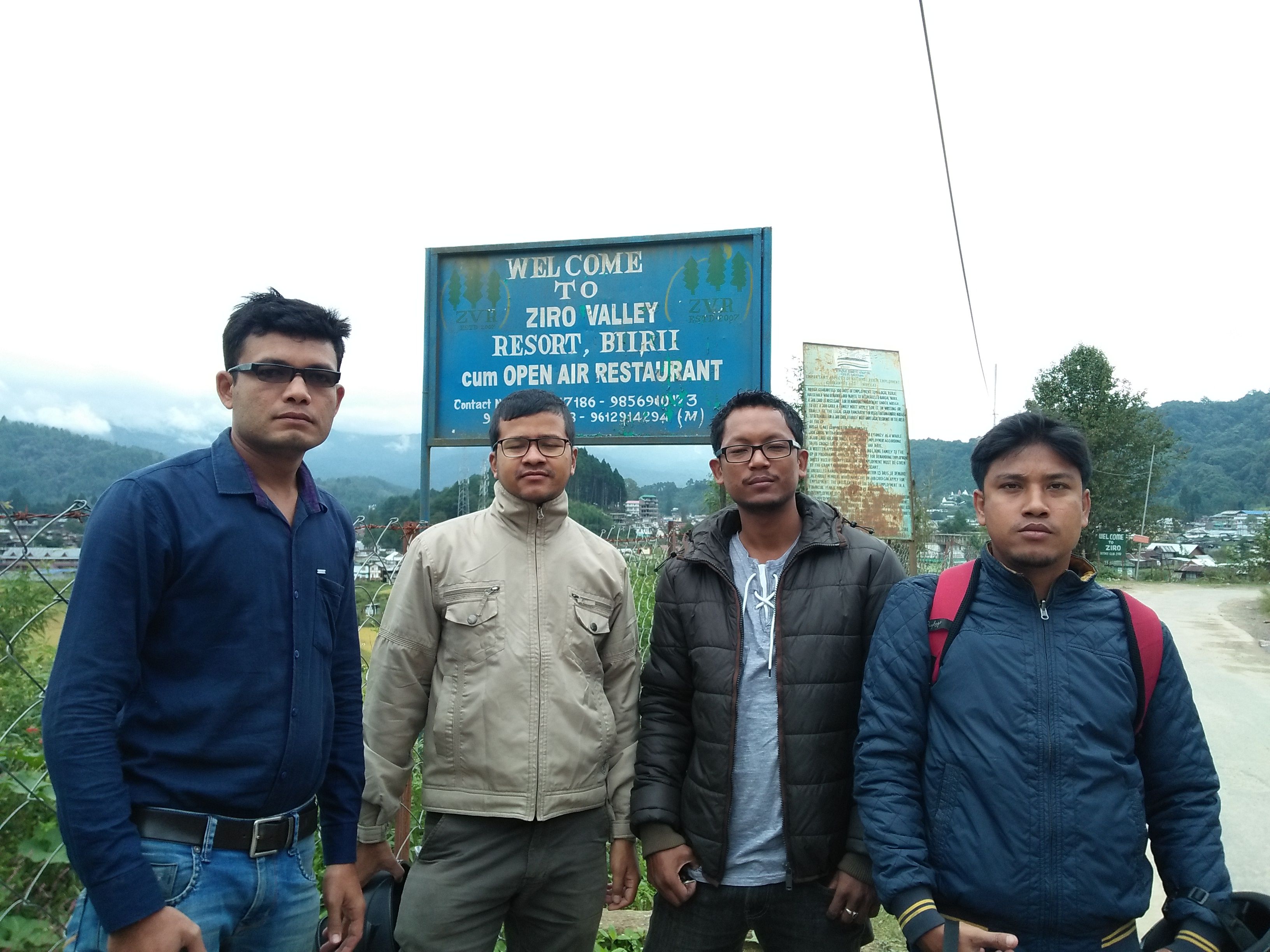
Annual rainfall in the south is heavier than that in the northern areas of the district. During the monsoon period more than 70 percent of the rain over the southern half occurs while in the northern portions it is about 60 percent. Variability of rain fall for the monsoon and the year, as a whole, are relatively small. Average annual rainfall of the district headquarters, Ziro recorded as 934.88 cm during 2000.
Relative humidity is always high throughout the year except in the winter months being slightly less humid. In the cold season, the sky is obscured on many mornings due to lifted fog which clears with the advance of the day generally, moderately clouded in the period of March to May, heavily clouded to overcast in the monsoon season and clear or slightly clouded during the post monsoon season. Winds are generally light strong katabatic winds down the valleys are experienced as local effect produced by the nature of terrain.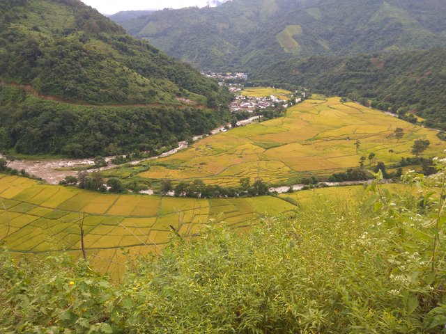
Congratulations @gogoi! You have completed some achievement on Steemit and have been rewarded with new badge(s) :
Click on any badge to view your own Board of Honor on SteemitBoard.
For more information about SteemitBoard, click here
If you no longer want to receive notifications, reply to this comment with the word
STOPCongratulations @gogoi! You received a personal award!
Click here to view your Board of Honor
Congratulations @gogoi! You received a personal award!
You can view your badges on your Steem Board and compare to others on the Steem Ranking
Vote for @Steemitboard as a witness to get one more award and increased upvotes!