Warning: Hurricane Michael to Be 'Strongest Ever' Storm to Hit the Florida Panhandle
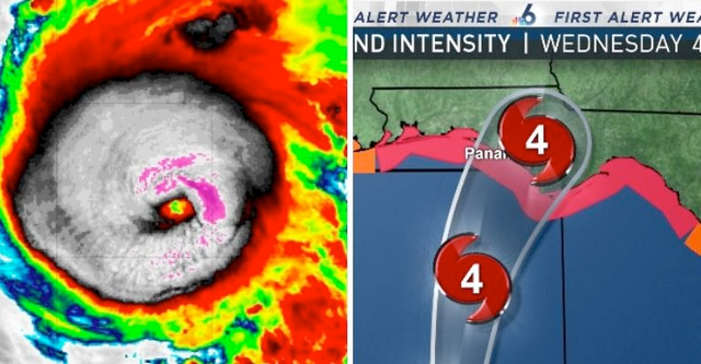
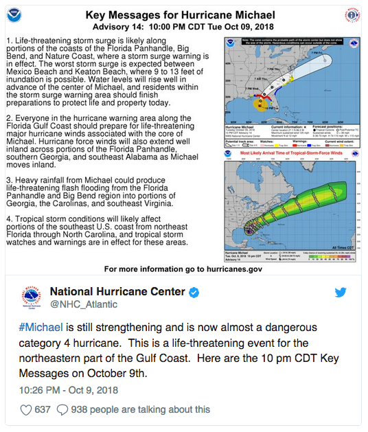
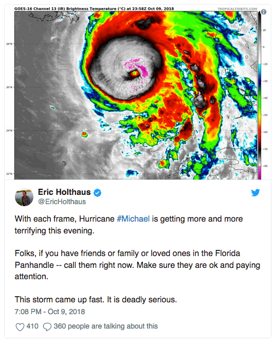
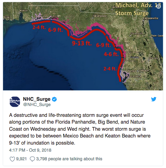
Hurricane Michael is now an ‘extremely dangerous’ Category 4 storm after quickly gaining strength in the Gulf overnight into Wednesday morning as it drew closer to Florida, having been just a small tropical disturbance as recently as Sunday. According to the National Hurricane Center, Michael will bring with it life threatening storm surge and winds.
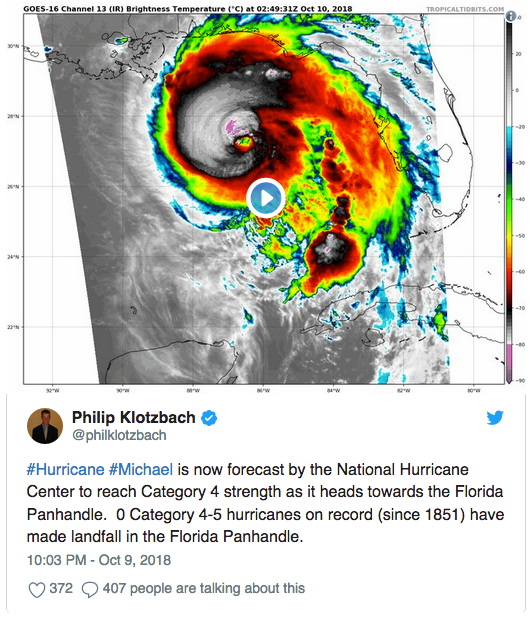
According to meteorologist Phil Klotzbach, there are no Category 4 hurricanes on record making landfall along the Florida panhandle. Florida Governor Rick Scott said Michael is expected to be “the most deadly, destructive storm to the panhandle in decades.”
Weather Channel hurricane expert Dr. Rick Knabb tweeted:
"This isn’t going to be like past western FL panhandle/AL majors like Dennis, Ivan, Opal, Eloise. And it’s not like Hermine, Kate farther east but weaker. Michael will make new history for central Panhandle, Big Bend. Some of you could get water and wind worse than ever before.”
On Tuesday, The White House issued a statement after President Donald Trump approved Florida’s Emergency Declaration as the storm approached the southern U.S. state.
“Today, President Donald J. Trump declared that an emergency exists in the State of Florida and ordered Federal assistance to supplement State and local response efforts due to the emergency conditions resulting from Hurricane Michael beginning on October 7, 2018, and continuing.”
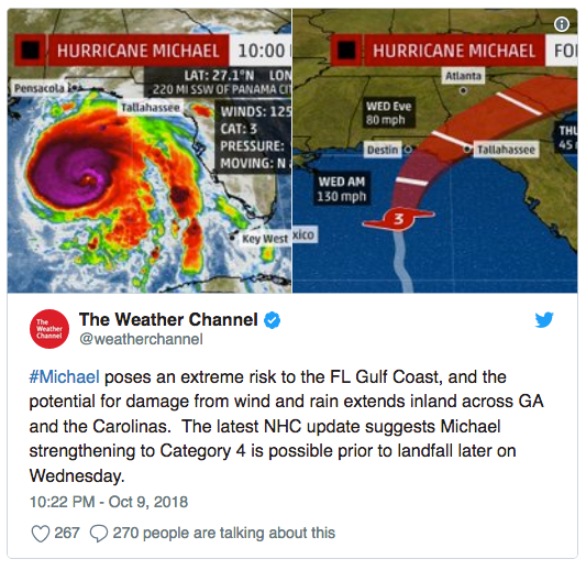
According to models, Hurricane Michael is expected to make landfall near Panama City, Florida on Wednesday afternoon. The path and area of landfall is not expected to change, nor is the storm expected to weaken prior to landfall.
“A potentially catastrophic event is developing,” the National Weather Service office in Tallahassee, Florida, wrote Tuesday night. “Locations may be uninhabitable for weeks or months.”

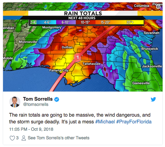
Rainfall totals may reach upwards of 20 inches in Panama City.
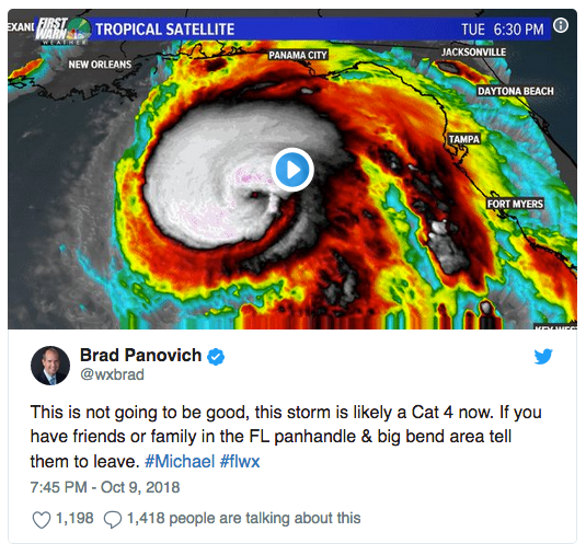
The storm gained strength and speed quickly, catching many Floridians off guard. Meteorologists have taken to social media to warn Florida residents.
Water levels are expected to rise significantly as Michael reaches northeastern Gulf Coast. As previously reported by The Mind Unleashed, this poses additional risks for coastal and inland residents alike due to the ongoing so-called red tide. Water laden with harmful toxins may find their way inland, onto land and into additional waterways with the surge.
Unfortunately, residents of the Carolinas, who are still dealing with devastating hurricane damage thanks to Hurricane Florence, will not come out from Michael unscathed. According to The Weather Channel, “the potential for damage from wind and rain extends inland across GA and the Carolinas.”
As always, heed local warnings and evacuate when possible.
This article first appeared on The Mind Unleashed.