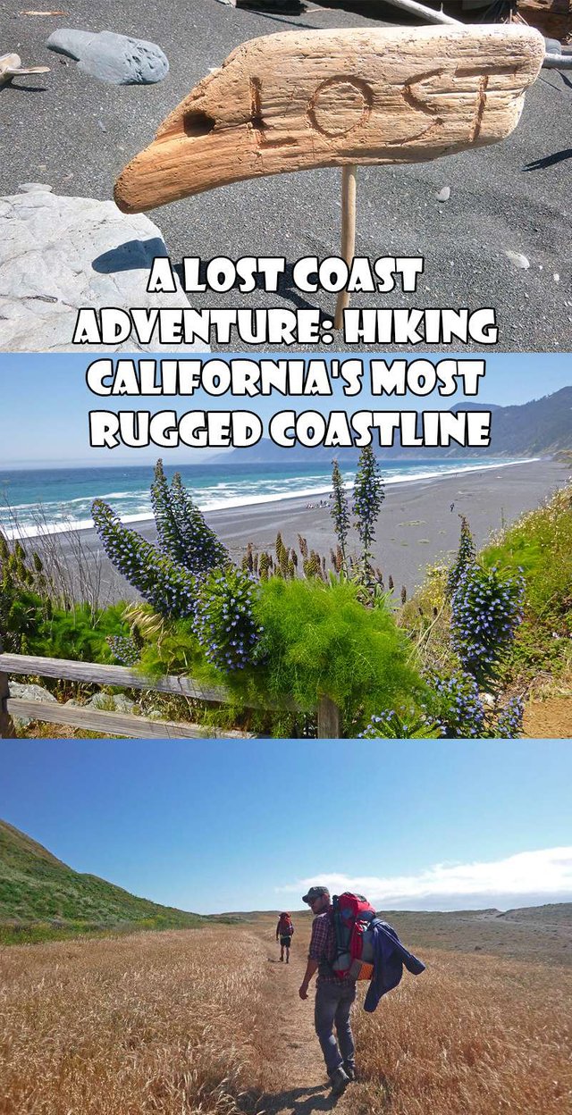
Lost Coast: Hiking California's Most Rugged Coastline
The Lost Coast in California
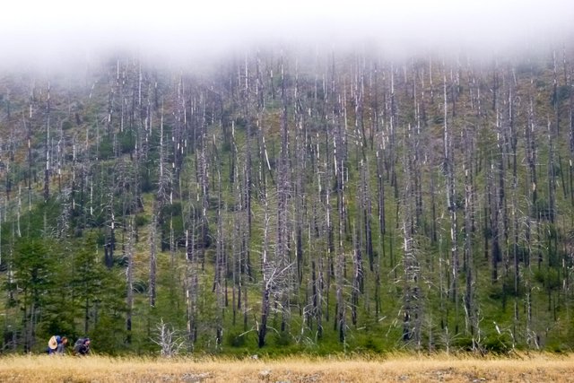
Up north on the California coast. There is a section of an unspoiled stretch of shoreline so rugged and so steep that modern highway builders deemed it impossible to build a road on. After seeing the terrain, the highway builders high-tailed it outta there to find an easier route. While Highway 1 could tame Big Sur. It couldn't do the same to the rugged Lost Coast as it veers inland 20 miles around this remote section of coastline.
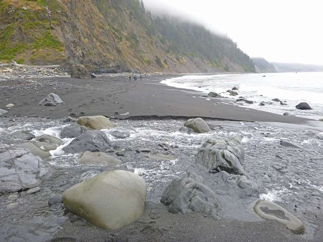
Rugged Beaches
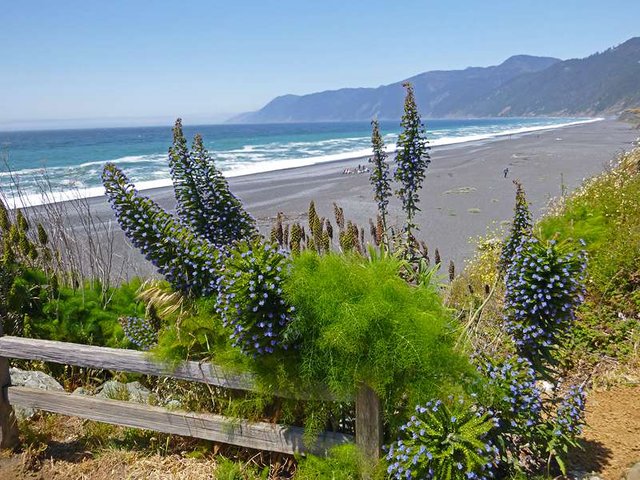
Their retreat left a rare slice of a wilderness trail that's become one of the premier beach-hugging hikes in the world. With the King's Range National Conservation Area and the Sinkyone Wilderness State Park. It is the longest extent of coastline in the continental United States with no developed road beside it. You can tackle this 26-mile trail where you’ll straddle the seam where ocean and land meet. But be at the mercy of tidal forces and unpredictable weather.
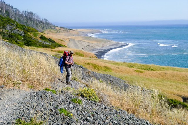
Northbound Trail from Shelter Cove
You’ll need knowledge about tides to pass sections where cliffs and waves meet. Once the tides sweep in the trail becomes impassable. This shouldn't dissuade you. There are otters and sea lions basking on the beaches. There's the possibility of spotting a whale over the horizon. You'll run into deer and bald eagles. You might have to run away from mountain lions.
Let that sink in for a minute...
It is wild here. If you want an escape away from the concrete jungles and sound of automobiles, this is it. You come here to get away from it all even for just a weekend, that's just what we did. When you step foot onto the solitary convergence of ocean and land. Scramble on the slopes of the earthquake active Kings Range. Walk along Madrones and gnarled Douglas fir trees. Dodge sword fern that’s growing so wild it obscures the trail. When you’re scrambling onto a rocky beach wedged between unscalable cliffs as the surf pounds at the near high tide.
You are, without a doubt, caught in the primal web of nature’s bounty. Disconnected from the modern world and engrossed in an awe-inspiring landscape.
Fine Black Sand
There are several approaches to this trail, one is southbound and other northbound. The most popular is the southbound trail which starts at the Mattole Beach trail and ends at Shelter Cove.
The northbound is just the opposite or you can complete the loop. You can arrange a shuttle service to pick you up at the end of your hike or they can shuttle you to the Mattole trail. You then end up at Shelter Cove where you can park your car. Bear canisters are required. However, the ranger station rents some for $5.
You can tackle this 26-mile trail in a leisurely fashion or blaze it, depending on your abilities. We approached somewhere between, taking 2 nights and 3 days to complete the trail from north to south.
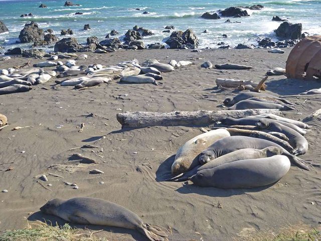
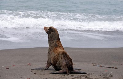
Basking Sea Lions
Hiking the trail!
The following itinerary is not intended to be followed verbatim. This was based on my experience. As always, please take all the proper safety precaution. The wilderness is a beautiful place but can also place you in danger if you don't come prepared.
DAY 1 (Mattole Beach to Spanish Flat)
We arrived at Mattole Beach early in the afternoon and sorted out our wilderness permits; some rangers checked to see we had bear canisters (required). We had our vehicle driven back to Shelter Cove via the Shuttle company. We then hit the trail and lose ourselves in the vast beauty of coastal divide.
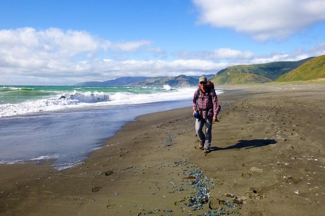
Hiking along the coast
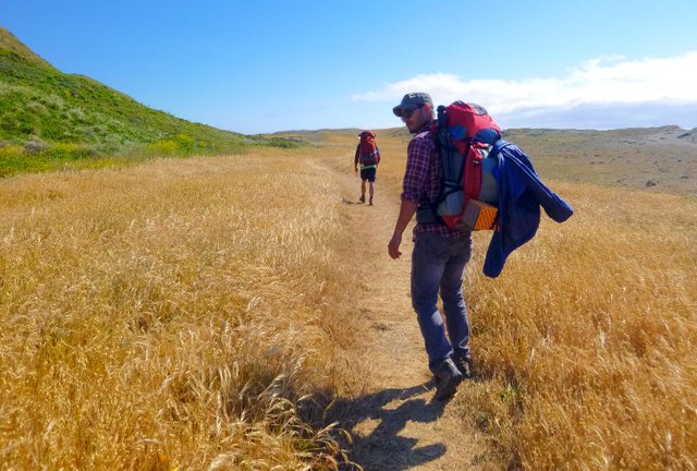
There are bits of trail that are easy to see, but we walked on the beach enjoying the first mile until realizing that walking on sand isn’t as energy-efficient and tiring. There’s an initial climb at around the 3rd mile in single-track switchbacks which when combined with sand provides quite a workout; It wasn’t soon after then I shed layers for a lighter base to soak in and be exposed to the cool breeze.
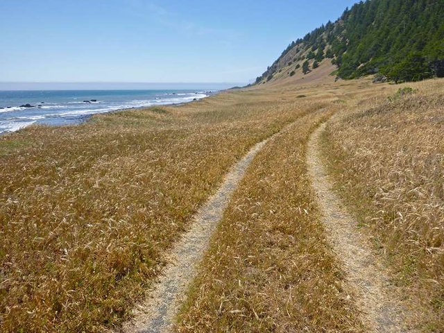
Lost Coast Trail
You can walk on the beach and sand, it’s enjoyable and relaxing. But do it for a good amount of time and it becomes taxing. I recommend you to take the trail when you see it as the coastline is in constant influx. At the 2.5-mile mark is an impassable terrain during high tide. Plan accordingly (tide charts are available so plan ahead). In the event you're caught on high tide you can scramble up the bluffs and walk right around it.
We went past Four Mile Creek and saw a few weathered private cabins, there are no traces of roads, power lines or the sort. It sort of reminded me of those cliff farms in Norway that baffled me about how they got up there and why? We scrambled past the Punta Gorda Lighthouse at mile 4 and past Sea Lion Gulch stopping for a break and checking out basking Sea lions.
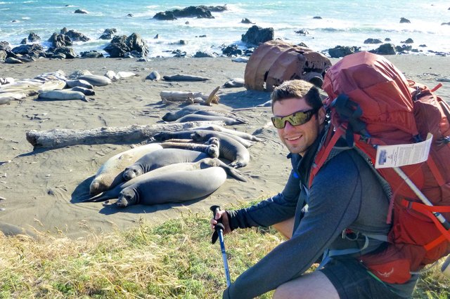
Lost Coast Sea Lions
The Sun was already low on the horizon when we reached the LCT junction. We decided not to push on to Spanish Flat and scrambled to find a campsite to pitch our tents and call it a day.
DAY 2 (LCT Junction to Miller Flat)
I woke up late in the morning, the fatigue is no doubt contributing to a fairly good night’s sleep (and a few edibles). My companions were already up waiting for my lazy bum to join. We fired up our portable stoves, made breakfast burritos while enjoying the view of the coast and chilling to the motion of the ocean waves.

A suitable camp location on the Lost Coast. We packed our tents and continued our hike knowing that the next several miles of the Lost Coast Trail will be on the beach, and there’s a section are impassable at high tide we were hoping to avoid.
It was busy this particular weekend because of the Veteran's Day holiday, the trail was full of hikers and campgrounds littered with tents. If you want more solitude I recommend you go in the off-peak winter months and early spring seasons, I would imagine the depth of solitude to be found here can only heighten the experience.
Meandering On The Trail
We made it to Miller Flat at mile 8 from the LCT Junction but the tide had already kicked high gear, we couldn’t pass. We called it day and spend the last night of the trip at Miller Flat.
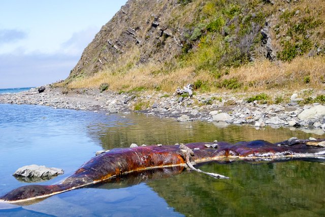
The carcass of a beached whale
A word of caution
There are signs throughout the trail and at Shelter Code warning of earthquakes and tsunamis, menacing things called “rogue” or “sleeper” waves. There has been several fatalities and people getting washed off the beach, the maps denote huge sections of the coastline impassable. The signs are there for a reason, please take heed.
DAY 3 ( Miller Flat to Shelter Cove)
We broke camp and hit the beach just before 9 a.m. We had consulted the tide table and it said there won’t be a high time incoming for another 4 hours - the BLM recommends to not to be hiking on the “impassable” stretches on “for an hour on either side of high tide.”
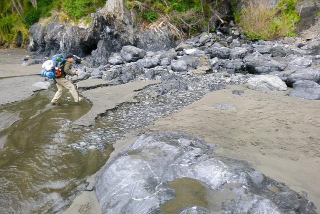
Crossing the River
We did the math and figured we could cover the whole stretch within that time-frame. This would a perfect time to frolic in the sand and twirl around on the beach. But then again, there was no sand. Just pebbles, black, shiny as marbles, and miles and miles of them lining the beach. And while beautiful to behold, some were as large as bowling balls, some aren’t as smooth, and still jagged from erosion.
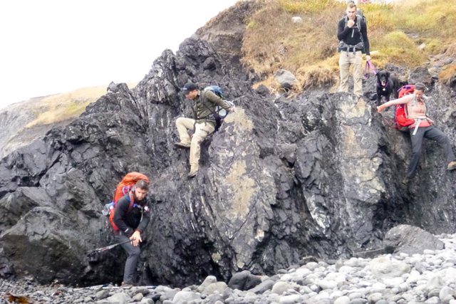
Some of the trails are steep
My lack of trekking poles proved to be a hindrance, footing was difficult. Even as we felt to rush past the “impassable at high tide” section and make good stride around the bend while pushing further south towards Shelter Cove, we had to stop and be in awe at the foamy surf as it slid between boulders to found tributaries and back again.
Home stretch
There’s a spot called the Ghost Point where surfers tackle waves roaring in like a rampaging beast, ready to fight a battle against a matador, skimping around the bend preparing another tidal onslaught.
The rest of the trail is gated by mountains on the left and the forest drop sharply down to the beach. The scenery was breathtaking, but we were eager to reach Black Sands Beach trailhead for a warm meal and cold beer.
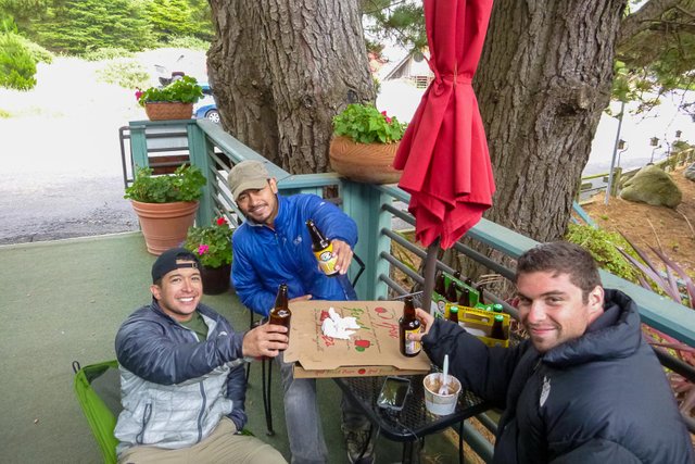
Obligatory beer after the long hike
Where is the Lost Coast?
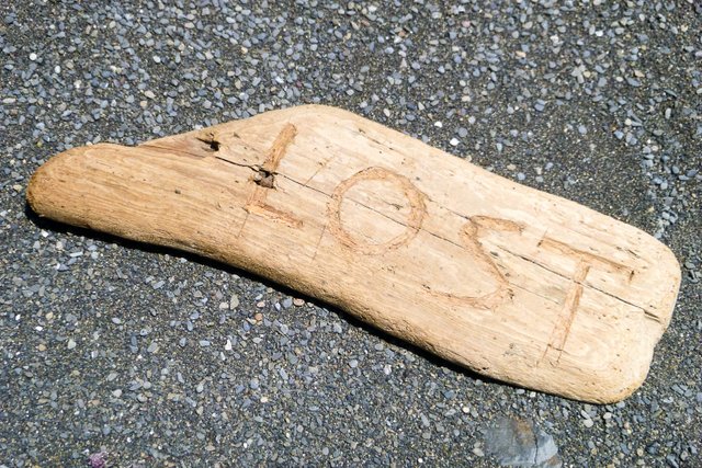
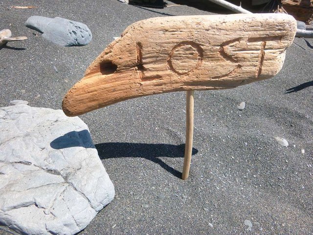
Lost Driftwood
There are two places where you can use the trail, from the South via Shelter Code and from the north via Mattole Beach. To reach Shelter Cove, take the Garberville exit off Highway 101, heading west on Shelter Cove Road. Make a right on Beach Road and continue about a mile to the Black Sands Beach parking lot. To reach Mattole Beach on the north end of the Lost Coast, take Lighthouse Road west from Petrolia, all the way to the end.
Solid Trails Optional
Hotels
The Tides: 59 Surf Point Road Inn of the Lost Coast: 205 Wave Drive Shelter Cove Oceanfront Inn: 26 Seal Drive
Restaurants
Cove Restaurant (at Shelter Cove Oceanfront Inn). 707-986-1197 Delgada Pizza: (at Inn of the Lost Coast) (707) 986-7672 King Range Conservation Area trails and camping information Lost Coast Shuttle Service: (707) 986-7437
MAP: [//]:# (!steemitworldmap 40.435925 lat -124.402379 long d3scr)
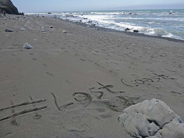
HAVE YOU HIKED THE LOST COAST TRAIL?
Posted from my blog with SteemPress : Lost Coast
i've been following you maybe 2 weeks now.. and you've done great with this steem flatform. can you give me some tips how i can start earning here.. please....
It's going to be tough when you first start out. Join some discord channels and groups and start there :)
how can i join channels and groups, can you guide me how?
Great adventure, didn't expect such a scenery in California, thanks 4 sharing your wonderful pictures!
Lost? :-D It's worth getting lost like that in that way!!
exactly!
Have fun, enjoy your day!!🤗✌👌
I heard about lost Coast Beach California but never seen Such Photographs. Mattote Beach is one of the best beach in California Lost Coast Specially the camping near the Mattole beach always gives a awesome feelings.
But I find one more thing that was unknown for me Sea Lions and their pics, because sea lions used to take rest during sunny day.
I took 15 minutes to read this Blog and found you shared your own experience of about Beach.
Every visitors want to take Pictures and selfie with Sea lions but only few of them were lucky and you was one the lucky guy who take pictures with Sea Lion..
oh god without a doubt that walk was full of adventure
This is so fantastic place, love to be there. Walking such various landscapes, discovering such things - its an essence of great trip. And of course, great relation from it. Thanks a lot for sharing! Totally well done post!
I also agree with you...
@adonisabril, hey man you just made us a small & wonderful trip to coast California, thanks a lot and keep posting such tracking adventure trip of you.
Beautiful place..beautiful pictures buddy keep hiking
I walked mattole beach who a girl in black bikini.. thanks friend information
What is the reason of coast loss?