Of Mind and magic
As a teenager, I once saw a black and white photograph of a magnificent landscape in a friend’s father’s study. I didn’t know quite what I was looking at. But, transfixed by the silvery squiggles strewn over the jagged mountain, I knew that it was stunning.
“The Stelvio Pass,” said my friend’s father. And I nodded, the exotic image forever fixed in my mind's eye.
It was not until I was a cyclist, nearly two decades later, that I understood what a mountain pass actually was. A route over a mountain range, it aims to facilitate crossing by snaking through a gap between two peaks. It would be a mistake, however, to infer that a route of this sort is flat, or easy. No matter how you spin it, you are still crossing a mountain range after all. And so I soon learned to expect climbing when anything with the words Pass or Gap in the name was involved.
Still, in those parts of the world where I've lived, the passes and gaps have tended to be rather tame, straightforward affairs: some miles up, then down, with a few sweeping bends. That iconic image of dense bundles of switchbacks was something I'd only seen in photos.
I should have known that this was about to change, when I told a friend about our upcoming trip to Kerry. When I mentioned our plans to cycle over the Connor Pass and asked whether he'd done it himself, he responded with: "Ah yes, the Connor Pass is a must! It's a very ...European climb."
I did not know what he meant by that at the time, imagining vaguely a mountainside strewn with outdoor cafes and art galleries. But apparently, "European climb" means hairpins. Plenty of switchbacks and hairpins! But I'll get to that later.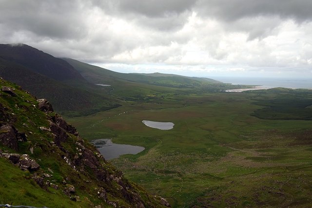
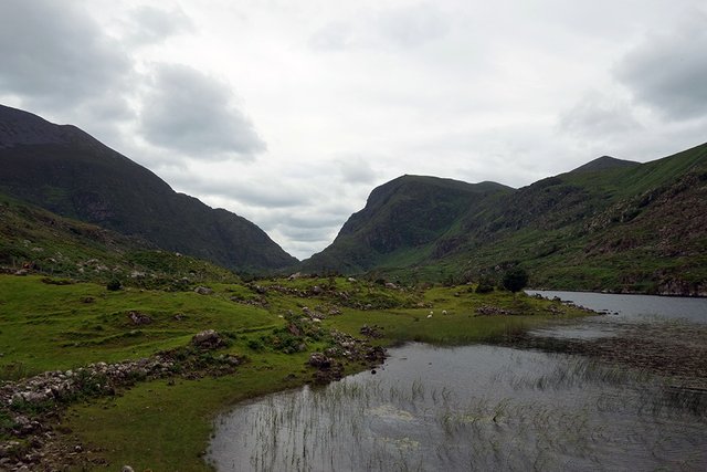
Located in one of the most scenic regions of Ireland, the Connor Pass slices lengthwise through the Dingle Peninsula at the south-western tip of the country, offering sweeping views of surrounding valleys and waterways. It is known as one of the highest paved mountain passes in Ireland and is a Category 2 climb. That said, it does not actually look too bad on paper: a not-quite-4 mile ascent, at 7-7.5% grade average. We headed toward it on the first day of our cycling tour, fresh and innocent. And as we pedaled into a moderate headwind from our starting point near Tralee, it almost felt like we needed the climb to burn off our excess of nervous energy. Had we packed enough things? Had we packed the right things? Would we find places to stay every night? Would it rain on us the whole time? Our minds needed to be quieted.
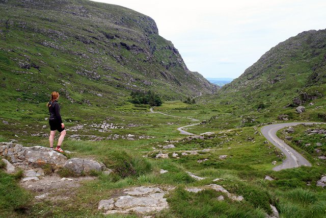
The usual route toward the Connor Pass is along a fairly flat coastal road that stretches for about 20 miles from Tralee through countryside that is attractive, but not overly dramatic - not counting the distant view of a mountain range that resembles a jagged knife's edge. The road starts out wide and fairly heavy with traffic. But at some point there is a fork, and a sign diverting lorries, buses, and other large vehicles onto a different road (thankfully, they are not allowed on the pass). The road toward the Pass itself grows narrower and quieter then, attaining a slight gradient. Then, after a sweeping bend, the view of the Connor Pass opens up.
I did not notice it at first. That is, I saw the steep face of the mountain when we rounded the bend, but did not see any road going up it. Then my husband shouted excitedly: "Look! There it is right there, you can see the road!"
"What! Where?"
Interesting post. Well done :)
Hi! This post has a Flesch-Kincaid grade level of 5.9 and reading ease of 84%. This puts the writing level on par with Jane Austen and JK Rowling.