Where Eagles Fly : Tushar Mountains ~ Flying Above the Mountains of Fishlake National Forest
Located on the eastern cusp of the gigantic geographic region known as the Great Basin, these are the Tushar Mountains. In the first image below Mount Belknap and Mount Baldy were formed between 22 and 32 million years ago by volcanic activity that included a calamitous explosion that blew off the top of a massive peak.
 Dusk over Mount Belknap & Mount Baldy ~ Click to Enlarge
I lensed this image as the sun was setting in the west (left side of this image) and the overhead clouds darkened the sky out over the valley on the other side of the range, leaving a sliver of golden alpenglow colored light as a backdrop to the snow covered peaks.
 Tushar Mountain Range ~ Click to Enlarge
The Tushar Mountains contain at least seven high alpine glaciated canyons, Cottonwood Canyon, North Fork of Cottonwood Canyon, South Fork Basin, The Pocket Basin, Bullion Basin, Beaver Basin and City Creek Basin. All were heavily glaciated during the last ice age which ended about 11,700 years ago.
Dramatic elevation changes across the range allows the Tushar Mountains to support numerous types of alpine and sub-alpine vegetation; mountain meadows, dense aspen and spruce/fir stands, ponderosa pine and Douglas fir, mountain brush, sagebrush steppe, pinion-juniper woodlands, oak, mountain mahogany, and upland mountain grasslands. The mountain range also contains locally native species only found here, such as the Tushar Paintbrush, as well as rare and sensitive plants.
(Research Source)
 Big Table Peak ~ Fishlake National Forest ~ Click to Enlarge
As you can see in the image above there are many remains of burnt forests and the recent fires in the area, both natural and prescribed, have been of great benefit to vegetation, causing regeneration of Aspen and other species.
 Marysvale Aside the Sevier River ~ Click to Enlarge
The Tushar Mountain Range contains a variety of annual and perennial streams that receive their flow from annual snowpack. The Sevier River, seen running down the middle of the valley next to Marysvale, Utah has a length of 383 miles (616 km), making it the longest Utah river that remains entirely inside the state borders.
This river drains an extended chain of mountain farming valleys down to the intermittent Sevier Lake. The Upper Sevier River is used extensively for irrigation, and consequently Sevier Lake is now essentially dry. Sevier Lake is a remnant of Lake Bonneville, a freshwater lake that covered much of the western and north western portions of Utah. Some of the more prominent creeks and streams that drain into the Seiver River are: Clear Creek, Pine Creek, Beaver Creek and Cottonwood Creek.
An interesting side note is that the entire watershed from the Tushar Mountains has a final terminus in Sevier Lake absolutely none of this water leaves the state nor reaches any ocean.
 Fishlake National Forest ~ Click to Enlarge
This image above is of the Fishlake National Forest to the north of the Tushar Mountain Range. In 1889 the First Nations Paiute Tribe sold the water rights for Fish Lake to the Fremont Irrigation Company for the sum of nine horses, 500 pounds of flour, one steer, and a suit of clothes. Ten years later President William McKinley created a Forest Reserve which included Fish Lake.
The National Forest covers 1.5 million acres (6,070 km²) and contains the famous Pando, a clonal quaking aspen stand, that, according to some sources, is the oldest (80,000 years) and largest (106 acres, 13 million pounds) organism on Earth.It is located in the Fremont River Ranger District of the National Forest, 1 mile southwest of Fish Lake.
I lensed these images while exploring this awe-inspiring wilderness area for my ongoing project, "Where Eagles Fly".
About The Project
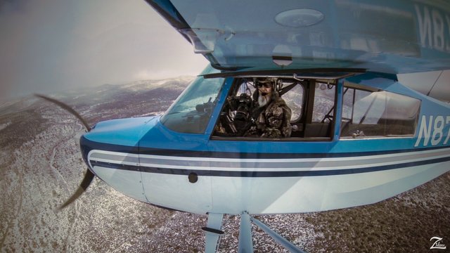
Where Eagles Fly - The American Wilderness Expedition is my personal mission to introduce people to these amazing locations that surround us. I am piloting a bush plane while exploring and filming throughout the remote back-country areas of North America to raise awareness of the 47% of the USA and 90% of Canada that remain unpopulated wilderness.
About The Author
My name is Zedekiah Morse and I'm a Bush Pilot, Photographer, Explorer and Filmmaker. I live in the Rocky Mountains and devote my time and resources to exploring as much of the world as I can by air. If you wish to watch a short film detailing how I do my work and this project, go here.
If you like what you see here upvote and resteemit so that others may experience these wondrous places.
And if you'd like these images to be part of your feed, follow me.
Thanks for your support and Yehaw!!
@skypilot, these pictures are breathtaking! While looking at them, I can only think of History and Poetry combined, and made easier to understand through the images captured by your lens.
By the way, the picture included in your "About the Project" section makes me believe you have traveled to the past, and these pictures, as well as the history behind each landscape, are here to prove it!
I look forward to the next encounter with Nature!.
Whoa! That is a cool comment for real!!!! Thanks so much for this.... really really nice!!!!!
wow very nice welcome. the mountains are fascinating
you are the best my friend. 😍😍😱😱
Fantastic post as usual, seriously though that opening shot is just incredible, looks like one of those shots where no matter how good it is it's never going to compare to seeing it for yourself. Which, given how bloody good it is must be pretty phenominal! The shot of the Sevier really stands out too!
Hey thanks LOL! Now don't go getting too used to these :) And you are so right! Nothing compares with being there in person. I am just really happy people enjoy seeing these images!! Really is cool
Great pictures!!
The Dusk over Mount Belknap & Mount Baldy photo is absolutely stunning. I could see this one blown up and mounted on a wall.