Oops, We Neglected to Mention the War Raging Below You
On Friday, August 8, 2008 the first European war of the 21st century broke out between Georgia, Russia, and the Russian-backed self-proclaimed republics of South Ossetia and Abkhazia.
At the time I was a U.S. Air Force intelligence officer assigned to the 60th Air Mobility Wing at Travis Air Force Base, California. My colleagues and I provided intelligence support for the air wing, which was composed of C-5, C-17, and KC-10 flying squadrons. These airlift and air refueling aircraft were vital to the global reach and dominance of the U.S. military.
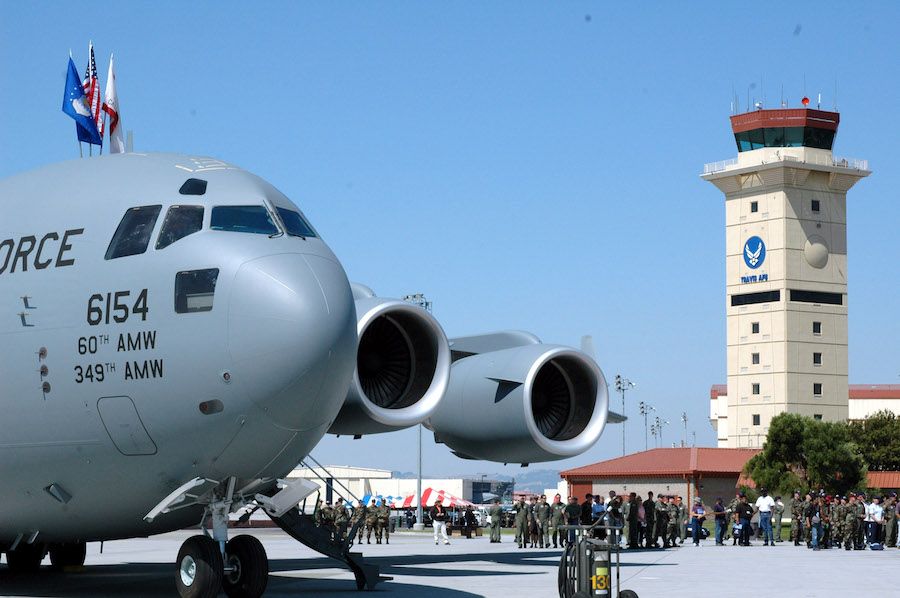
[a C-17 at Travis AFB, California]
At any given time “Team Travis” had aircraft and personnel on 5 different continents.
I was a member of the intelligence analysis branch tasked with tracking events around the world and identifying when emerging circumstances could impact the people, aircraft, and operations in our purview. We worked closely with pilots, flight engineers, and wing leadership to effectively assess and mitigate a full range of tactical and strategic risks.
As we came into work on Friday, August 8, we saw that the brewing tensions between Georgia and Russia had escalated into a full fledged shooting war. We quickly began to assess how this situation might impact our people and planes.
Matching a real-time corpus of global situational awareness data with a large portfolio of dynamic operations information is a significant challenge. Months earlier we had been drowning in a dearth of spreadsheets, PDF reports, PowerPoint presentations and Word documents. We scoured over these disparate data troves trying to identify connections and relationships. The undertaking was painstaking and futile.
My boss, Major Doug Cameron, had recognized the ineffectiveness of this endeavor and gave us a mandate to find a better way. This exploration eventually brought us to Google Earth. In early 2008, under Major Cameron’s guidance, the intelligence team completely retooled our operations and overhauled our workflows. We created a central repository for all threat (red) and operations (blue) information. We indexed this data based on time and geography (latitude/longitude) and made it accessible and discoverable via Google Earth.
We called this project “The Intersect” as it helped us visualize and identify the intersection of red and blue information.
When we checked the Google Earth display on the morning of August 8, we could clearly see that a C-17 from Travis Air Force Base was traveling along a route of flight that would take the aircraft over a wide swath of Georgian airspace. The aircraft had left California earlier in the week, and after remaining overnight at Ramstein Air Base, Germany for crew rest, was now en route to Bagram Air Base in Afghanistan.
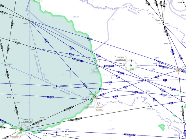
[the airspace transiting the Black Sea and Georgia]
We certainly didn’t think that the C-17 flying high along an international air route would be directly targeted by Georgian or Russian forces. The situation evolving below was volatile though, and if the crew needed to divert for fuel or an aircraft emergency, they could be doing so into an active war zone.
The deadly shootdown of Malaysia Airlines Flight 17 in 2014 would later show that unintended air defense engagements can happen in war zones, and when they do the results are catastrophic.
As intelligence professionals, my team and I would have lost significant credibility if the C-17 aircrew had found out later that they were flying over a large-scale European conflict and we had not apprised them of the situation. We risked being perceived as ineffectual and superfluous in the eyes of or customers.
In fact, this reputational peril was nearly realized. We called the intelligence shop at Ramstein Air Base, where the aircrew would have received a final intelligence update before they stepped to the jet. When we asked the analyst working the intel desk in Germany if he had briefed the aircrew on the situation in Georgia, he replied, “why would I brief them on Georgia, they are flying to Afghanistan?”
The visual nature of The Intersect allowed us to correlate and associate information that the analyst in Germany had simply missed.
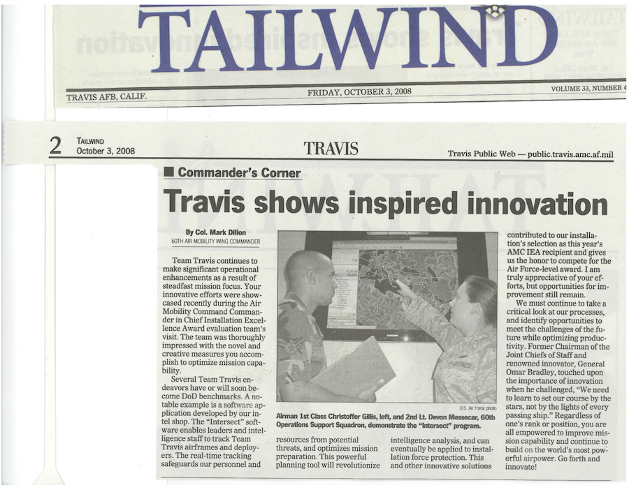
[an October 2008 article in the Travis AFB Tailwind about the success of the Intersect]
We worked with the aircrew tactics team, a group of aircrew members who specialized in adapting flying operations to counter evolving threats, to pass this information to the aircrew via satellite phone. When we reached them, the crew was flying over the Black Sea, just a few miles away from their entrance into Georgian airspace.
With the information we provided, the aircraft commander was able to mitigate the potential threat and safely execute the Afghanistan airlift mission.
This situation was a pivotal event in my professional development, as it gave me a deep appreciation for the power of adept data visualization.
Visualizations can sometimes be purely “eye candy”, in the form of extemporaneous charts or superficial infographics. When done right though, a compelling visualization can help humans identify connections and relationships.
On a piece of paper that simply listed Germany as a departure location and Afghanistan as an arrival destination, a linkage with the country of Georgia or with Russian military deployments was not immediately evident.
In reality, Germany and Afghanistan were just two nodes in a much larger network. By visualizing the geographic connectivity between these nodes (the link is not always linear, as in the case of circuitous flight routing) we were able to identify sources of risk that may otherwise not have been considered.