What happens when the eye of the hurricane enters?
A meteorologist explains what is experienced at the moment when the center of a tropical cyclone hits a territory
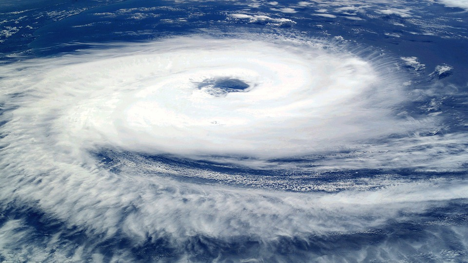
The meteorologist Odalys Martínez, from the National Meteorological Service (SNM), explained that "in that center as such there is an apparent calm". The danger is in the "wall" of that eye of the hurricane, he said.
According to the NHC glossary, the eye of a hurricane is "the approximately circular area of light winds that encompasses the center of a severe tropical cyclone. The eye is completely or partially surrounded by the cloud on the wall of the eye. "
Martinez explained that, when a sector is in that eye area, "in many occasions you can see clear skies, but that is momentary."
On the other hand, the NHC indicates that the "eye wall is an organized band or ring of cumulonimbus clouds that surround the eye or center of a tropical cyclone".
It is here, in that wall of the eye of the hurricane, where the system loads the strongest winds and the most intense rain, said the meteorologist.
"We are talking about a very broad system and the bands can arrive before," said Martinez.
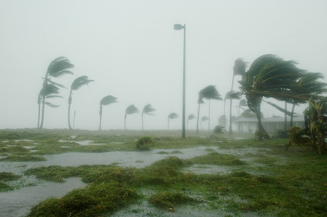
As the eye of the hurricane approaches the Borincan coastline, the most intense sustained winds will be recorded.
"You will experience the rain and the associated rain, a relative calm (with the entrance of the eye) and then the wind and the rain associated with the system start again. This detail of the conditions of rain, calm, rain, will depend on the speed of translation of the system, "he explained.
Currently, Maria is moving at nine miles per hour, a step that has been described as slow. However, the expert did not venture to project the period in which that eye would give the sensation of "calm".
What he did emphasize is that people should not leave their shelters at the moment of this "apparent calm", since it would be dangerous.
"The reality of the case is that you do not know again when the conditions are going to start getting worse," he said.
On the other hand, the meteorologist explained that the amount of rain and maritime conditions that would be generated are not "necessarily associated with the eye", but the entire system.
Maria is expected to leave between 12 to 18 inches of rain and in isolated areas up to 25 inches.
Martinez said that much of this accumulation of rain could be recorded after the departure of the island system, when they begin to feel the effects of the "tail of the system."
Many times we have seen that when the system goes away and the queue comes it is that the rain leaves us, "he said.
Regarding maritime conditions, the NHC projects that it would generate cyclonic swells of up to nine feet, "which can be accompanied by large and destructive waves".